Call us now :07971189175

 Send Inquiry
GeoCoPS Software
MOQ : 1 Piece
GeoCoPS Software Specification
- Support System
- Windows OS, Customer Support
- Language Support
- English
- Compatible System
- Windows 7/8/10
- Usage
- Precision Survey Calculations, Mapping, Geodata Management
- Capacity (Person)
- Single/Multi-user operation
- Interface Type
- Graphical User Interface (GUI)
- Security Features
- Password Protected Login, Data Encryption
- Type
- Geospatial Software
- Application
- Geographical Coordinate Processing
- Processor Requirement
- Intel i3 or equivalent and above
- Software Version
- V2.5
- Minimum RAM Required
- 4 GB
- Update Frequency
- Annual
- License Type
- Perpetual/Subscription
- Installation Type
- Offline Installer
- Documentation
- User Manual and Online Help
- Data Import/Export
- CSV, DXF, KML formats
- Network Capability
- LAN and Standalone Mode
- Screen Resolution
- 1024 x 768 or higher
- User Training
- Included with Software
GeoCoPS Software Trade Information
- Minimum Order Quantity
- 1 Piece
- Supply Ability
- 10 Pieces Per Week
- Delivery Time
- 4-12 Week
About GeoCoPS Software
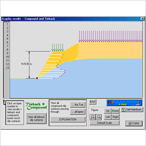
GeoCoPS is an interactive program for the design of geosynthetic tubes.
Here are the features of GeoCoPS:
Output is presented graphically. The cross-section can be captured as a bitmap file. Most CAD programs can retrieve this file for further modifications. Most word-processors can also retrieve it for integration into a user-compiled report. Coordinates of cross-section can be exported to Excel.
Three analysis options are available:
- If the given data includes the ultimate strength of the geosynthetic, GeoCoPS computes the geometry of the tube utilizing this strength. The analysis accounts for reduction factors such as installation damage, creep, aging, and seam strength.
- If the given data specifies the maximum height of the tube, GeoCoPS computes the required ultimate strength of geosynthetic as well as the geometry of the tube.
- If the pumping pressure is input, GeoCoPS computes the required ultimate strength of geosynthetic as well as the geometry of the tube.
For either analysis, the cross-sectional area of the tube is calculated. Consequently, the storage capacity of slurry is part of the solution.
Recognizing that geosynthetics are typically anisotropic, GeoCoPS produces both the circumferential and longitudinal stresses in the encapsulating geosynthetic.
Different reduction factors for seams in axial and circumferential directions can be specified (useful for seamless tubes).
Input data allows for up to two slurry layers to be considered in analysis. This feature is useful in case the first layer is pumped into the tube, followed by consolidation (i.e., allows water to seep out while the slurry density increases as its total volume decreases) and then being re-pumped with a second layer of slurry.The second pumping phase can be assessed using GeoCoPS.
Analysis of tubes that are partially or totally submerged in fluid (typically water) can be conducted. This realistic possibility allows for a rational reduction in the required geosynthetic strength in case of submergence. This reduction can be significant.
A detailed report, including graphical presentation of cross-section, can be printed. It can also be previewed prior to printing. Printing of report or capturing of bitmap files can also be done in black and white to improve reproduction and/or transmittal via fax.
The consolidated shape of the tube can be calculated using an approximated (simplified) approach. This feature may be important for long-term assessment of storage capacity or when tubes are used for the construction of dikes. The consolidated shape can be captured as a bitmap file. The graphics and calculated values appear as part of GeoCoPS printed report.
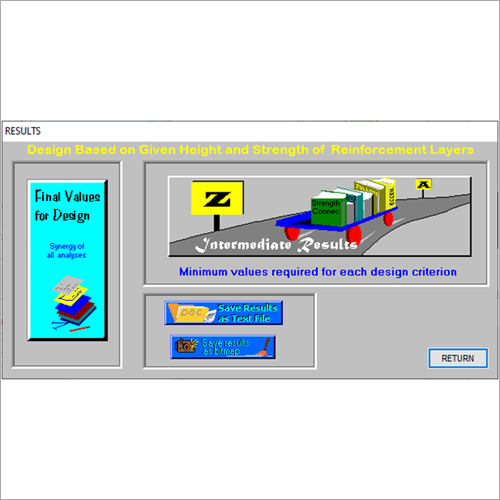
Results can be saved as a text file. This file can be retrieved by most word processors for integration into a user-compiled report.
GeoCoPS calculates the geosynthetic and fill material quantities. Upon entering unit cost, it displays or prints the total costs.
Seamless Geospatial Processing
GeoCoPS Software streamlines geographical coordinate processing for surveyors and mapping professionals. Its precise algorithms and data interoperability enable accurate survey calculations, geodata management, and mapping. The annual updates ensure users have access to the latest enhancements and data handling capabilities.
Flexible Licensing and Easy Installation
The software is available with perpetual or subscription licenses, accommodating both long-term and short-term project needs. Installation is simple with its offline installer, and the application can operate in standalone or LAN modes, allowing for single or multi-user setups depending on organizational requirements.
Comprehensive Training and Support
GeoCoPS includes extensive user training alongside a detailed user manual and online help resources. Expert customer support is readily available to address technical queries, ensuring smooth onboarding and optimum software utilization for users across India.
FAQ's of GeoCoPS Software:
Q: How can GeoCoPS Software be installed on my Windows system?
A: GeoCoPS V2.5 is provided as an offline installer, allowing you to set it up on Windows 7, 8, or 10 without requiring an internet connection. The installation process is straightforward, and detailed instructions are included in the user manual.Q: What data formats does GeoCoPS support for import and export operations?
A: GeoCoPS conveniently supports CSV, DXF, and KML file formats for both importing and exporting geodata, enabling seamless integration with major mapping and surveying applications.Q: When are software updates released for GeoCoPS V2.5?
A: Software updates for GeoCoPS are rolled out annually, ensuring you benefit from the latest features, performance enhancements, and security improvements every year.Q: Where can users access support and training for GeoCoPS Software?
A: Training is included with the software package, and users have access to a comprehensive user manual and online help. For further assistance, customer support is available through the distributor, service provider, supplier, or trader across India.Q: What are the hardware requirements for running GeoCoPS efficiently?
A: The minimum system requirements include 4 GB RAM, an Intel i3 processor or equivalent, and a screen resolution of 1024 x 768 or higher. These specifications ensure smooth operation and optimal performance.Q: How does GeoCoPS Software benefit professionals in geodata management and mapping?
A: GeoCoPS automates precise survey calculations and geodata management while supporting multi-user workflows, enhanced data security, and streamlined mapping projects, thereby boosting productivity and accuracy for professionals.Q: What security features protect data within GeoCoPS Software?
A: GeoCoPS maintains data security through password-protected login credentials and data encryption, safeguarding sensitive geographical information during storage and processing.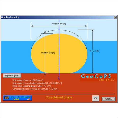
Tell us about your requirement

Price:
Quantity
Select Unit
- 50
- 100
- 200
- 250
- 500
- 1000+
Additional detail
Mobile number
Email

More Products in Geotech Programs Category
MSEW Software
Price Range 50000.00 - 500000.00 INR / Piece
Minimum Order Quantity : 1 Piece
Support System : Online and Offline Support
Type : Other, Design and Analysis Software
Compatible System : Windows OS
Language Support : English
ReSSA Software
Price Range 50000.00 - 500000.00 INR / Piece
Minimum Order Quantity : 1 Piece
Support System : Windows
Type : Other, Software
Compatible System : Windows
Language Support : English
FoSSA Software
Price Range 50000.00 - 500000.00 INR / Piece
Minimum Order Quantity : 1 Piece
Support System : 24/7 Technical Support
Type : Other, Security Software
Compatible System : Windows, Linux, Mac OS
Language Support : Multilanguage (English and more)
ReSlope Software
Price Range 50000.00 - 500000.00 INR / Piece
Minimum Order Quantity : 1 Piece
Support System : Online and Offline
Type : Other, Geotechnical Engineering Software
Compatible System : Windows XP/Vista/7/8/10
Language Support : English
We are providing our products across India.
Our Products

B-302, Taj Enclave, Geeta Colony,Delhi - 110031, India

 Send Inquiry
 Send SMS
Developed and Managed by Infocom Network Private Limited.
