Call us now :07971189175

 Send Inquiry
Highways Design Software
MOQ : 1 , , Piece
Highways Design Software Specification
- Platform
- Windows
- File Size Limit
- Up to 500MB per Project
- System Requirements
- Windows 7/8/10, 4GB RAM, 500MB HDD
- Language
- English
- Error Checking
- Built-in Validation Algorithms
- User Interface
- Graphical, Menu Driven
- Design Features
- Alignment, Profiles, Cross-sections, Quantity Estimates
- Delivery Mode
- Digital Download
- Licensing
- Single User / Multi User
- Documentation
- Included
- Demo Version
- Available
- Multi-Language Support
- On Request
- Reporting Tools
- Integrated
- Security
- Data Encryption
- Topography Import
- Survey data integration
- Product Name
- Highways Design Software
- Cloud Integration
- Optional
- Customer Support Hours
- 9 AM to 6 PM IST
- Batch Processing
- Available
- Support
- Email & Phone
- API Access
- Available for Integration
- License Renewal
- Annual/Perpetual Options
- Type
- Design Software
- Custom Templates
- User-defined Templates
- Data Export
- CSV, DWG formats
- Application
- Highway & Road Infrastructure Planning
- Updates
- Regular Software Updates
- Compatibility
- Compatible with AutoCAD
- Training
- Online Tutorials
- 3D Visualization
- Supported
Highways Design Software Trade Information
- Minimum Order Quantity
- 1 , , Piece
- Supply Ability
- 4 Pieces Per Day
- Delivery Time
- 4-12 Week
About Highways Design Software
We are the most sought after supplier, indulged in offering highly innovative Highways Design Software. This software provides a complete solution for making the highways and roads design. It covers data survey to DTM, triangulation, junction, grade separators, carriageway design, 3D animation, drawing and more. Research, trials and feasibility tests are conducted for attaining the accuracy of this software. Also, the offered Highways Design Software is available with us at the most reasonable prices.
Features:
-
Perfect designing solution
-
Accurate tracking and analysis
-
User friendly interface
-
Regular updates
Enhanced 3D Visualization for Accurate Design
Design highway alignments, profiles, and cross-sections with precise 3D visuals. The software integrates survey topography data, enabling planners to validate and refine projects for real-world conditions. This visualization aids stakeholders in reviewing proposed infrastructure effectively.
Integrated Reporting and Batch Processing
The built-in reporting tools offer automated generation of project-specific documentation and quantity estimates. With batch processing, multiple design tasks can be handled concurrently, promoting faster delivery without compromising on quality or accuracy.
Flexible Data Handling and Secure Cloud Integration
Export project data in industry-standard CSV or DWG formats, ensuring smooth interoperability with AutoCAD and other platforms. Optional cloud integration and data encryption provide secure access and storage options, supporting collaboration across distributed teams.
FAQs of Highways Design Software:
Q: How does Highways Design Software facilitate 3D visualization in highway planning?
A: The software provides robust 3D visualization tools that allow users to create and analyze alignments, profiles, and cross-sections with realistic detail. Integrated survey data ensures that designs reflect existing topographical conditions for more accurate planning.Q: What reporting and data export options are available in the software?
A: Users can generate comprehensive reports directly from the software, including quantity estimates and design summaries. Data can be exported in CSV and DWG formats, making it compatible with AutoCAD and suitable for documentation or further analysis.Q: When is customer support available for this design software?
A: Customer support is accessible via email and phone from 9 AM to 6 PM IST, ensuring assistance during standard business hours throughout India for both technical and licensing queries.Q: Where can I access training and documentation for Highways Design Software?
A: Online tutorials, detailed documentation, and demo versions are provided with the digital download, allowing users to learn and reference features at their convenience, directly from their Windows systems.Q: What is the license renewal process for the software and what options are offered?
A: License renewal is available on an annual or perpetual basis. Users can choose between single-user or multi-user licensing options, ensuring flexibility for individual professionals or project teams.Q: How does the software ensure data security for highway design projects?
A: Highways Design Software employs data encryption for all stored and transmitted project files. Optional cloud integration further enhances security, providing safe access and backup for sensitive design data.
Tell us about your requirement

Price:
Quantity
Select Unit
- 50
- 100
- 200
- 250
- 500
- 1000+
Additional detail
Mobile number
Email

More Products in Civil Engineering Software Category

Integrated 3D Bridge Design Software
Price Range 50000.00 - 500000.00 INR / Piece
Minimum Order Quantity : 1 Piece

CSI Bridge Design Software
Price Range 50000.00 - 500000.00 INR / Piece
Minimum Order Quantity : 1 Piece

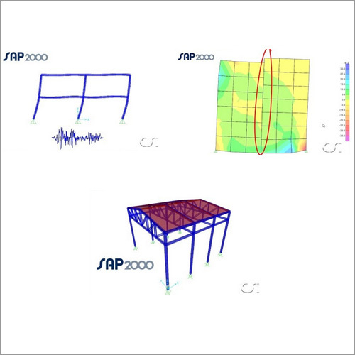
SAP2000 Structural Designing Software
Price Range 50000.00 - 500000.00 INR / Piece
Minimum Order Quantity : 1 , , Piece
We are providing our products across India.
Our Products

B-302, Taj Enclave, Geeta Colony,Delhi - 110031, India

 Send Inquiry
 Send SMS
Developed and Managed by Infocom Network Private Limited.
